Background and context
South Gloucestershire Council needs to deliver at least 22,500 homes over the next 15 years. Their objective is to deliver them in sustainable locations, accessible to shops, community services and employment. At the same time the Council expect a positive response to the challenges of climate change and the natural environment.
Surveys
As part of developing proposals for the site, a wide range of on and off site surveys have been carried out, including amongst others, drainage testing, transport surveys, ecology surveys, landscape assessment, heritage assessment, sustainability and healthy living assessments. This website shares some of that information to inform residents and interest groups.
Sustainable Location
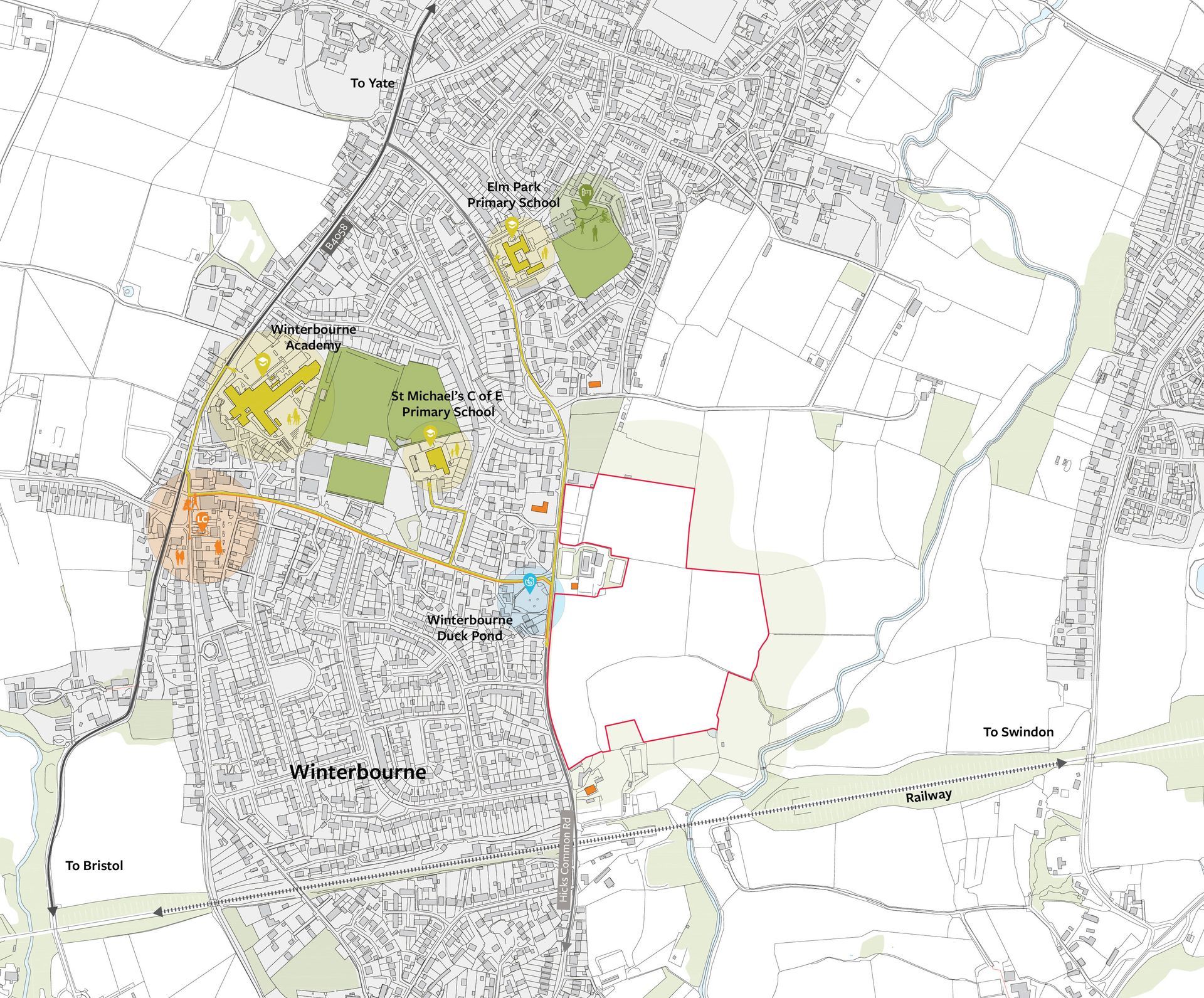
Winterbourne is recognised by the Council as a sustainable settlement. It has historically grown to the east of Bristol Road where residents benefit from primary and secondary schools as well as shops, and a good range of community services. These are all within walking distance of land at Hicks Common Road. The combination of local services and their proximity to the site supports the principle of walkable neighbourhoods and a reduction in private car travel. At this point, Active Travel (walking and cycling) is at its most convenient.

The Site
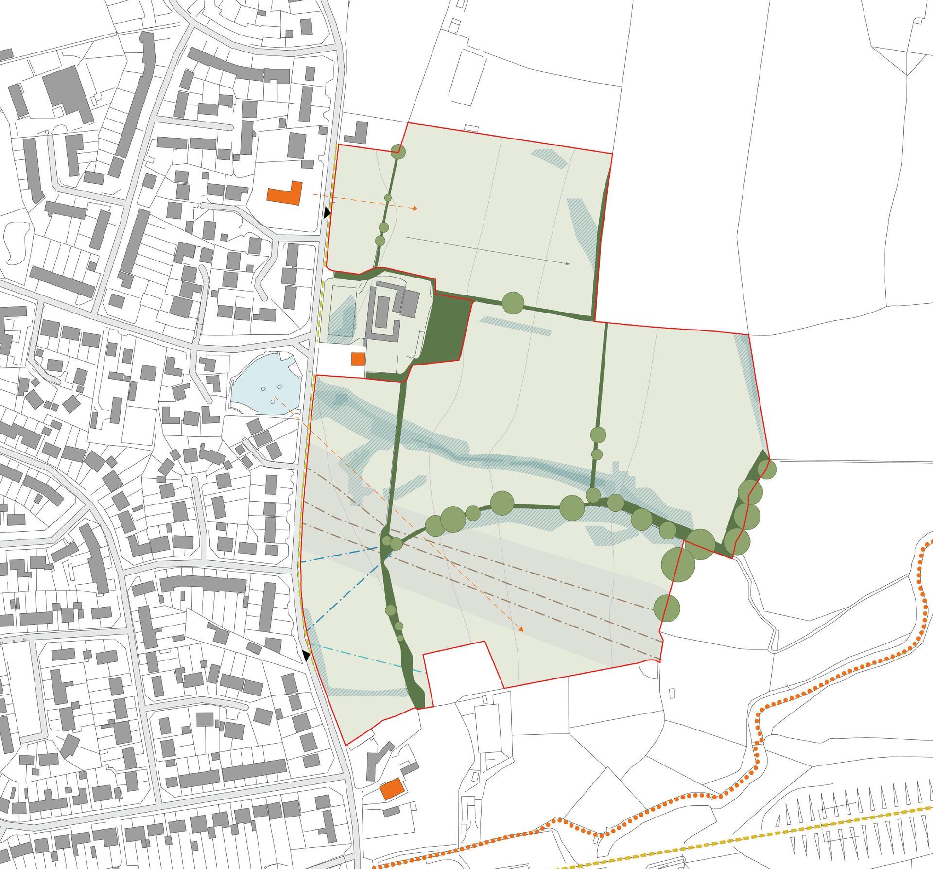
The 12.35ha site is greenfield and Green Belt land but meets the criteria for Grey Belt land. The proposals would retain the site in the Green Belt. Hicks Common Road has development along its western side with occasional dwellings and businesses to the east. Our landscape-led approach seeks to retain openness along the Hicks Common Road frontage through large areas of open space whilst using the sloping topography to position houses on lower contours than those to the west.
Land which may have formed part of a common stretching on both side of Hicks Common Road has either been developed or used as private horse grazing land with no public access. The proposals provide an opportunity to reverse this by creating large areas of public open space along the road frontage and especially around the Duck Pond. Existing stone walls and trees can be retained except to provide a single vehicular access and additional pedestrian/ cycle accesses. The existing pattern of hedgerows can be retained and strengthened except for necessary crossing points.
The site slopes down to the River Frome Corridor. The site falls outside of this ecological corridor but at the same time the proposals can strengthen it by providing biodiverse planting across large areas of open space on the lower slopes. The proposed development parcels would be screened from the Frome Valley Footpath. Development would be set back from Cloisters Road by one set of fields.
The biodiversity of the site is relatively low having been used for grazing and a measurable improvement can be achieved as part of development to support the neighbouring Frome Valley.
Within the site there are two corridors that have been identified to remain undeveloped, one relates to a potential overflow route for the Duck Pond and one relates to the presence of MoD pipelines, two of which are abandoned. Both corridors are proposed to remain undeveloped. Their alignment however informs the layout structure as demonstrated in the ‘Our approach’ below.
Our approach
